“Union Pier will be a vibrant waterfront space that enhances the quality of life for those who live in Charleston now and for generations to come.”
– Ben Navarro, Charleston resident, businessman and philanthropist
About
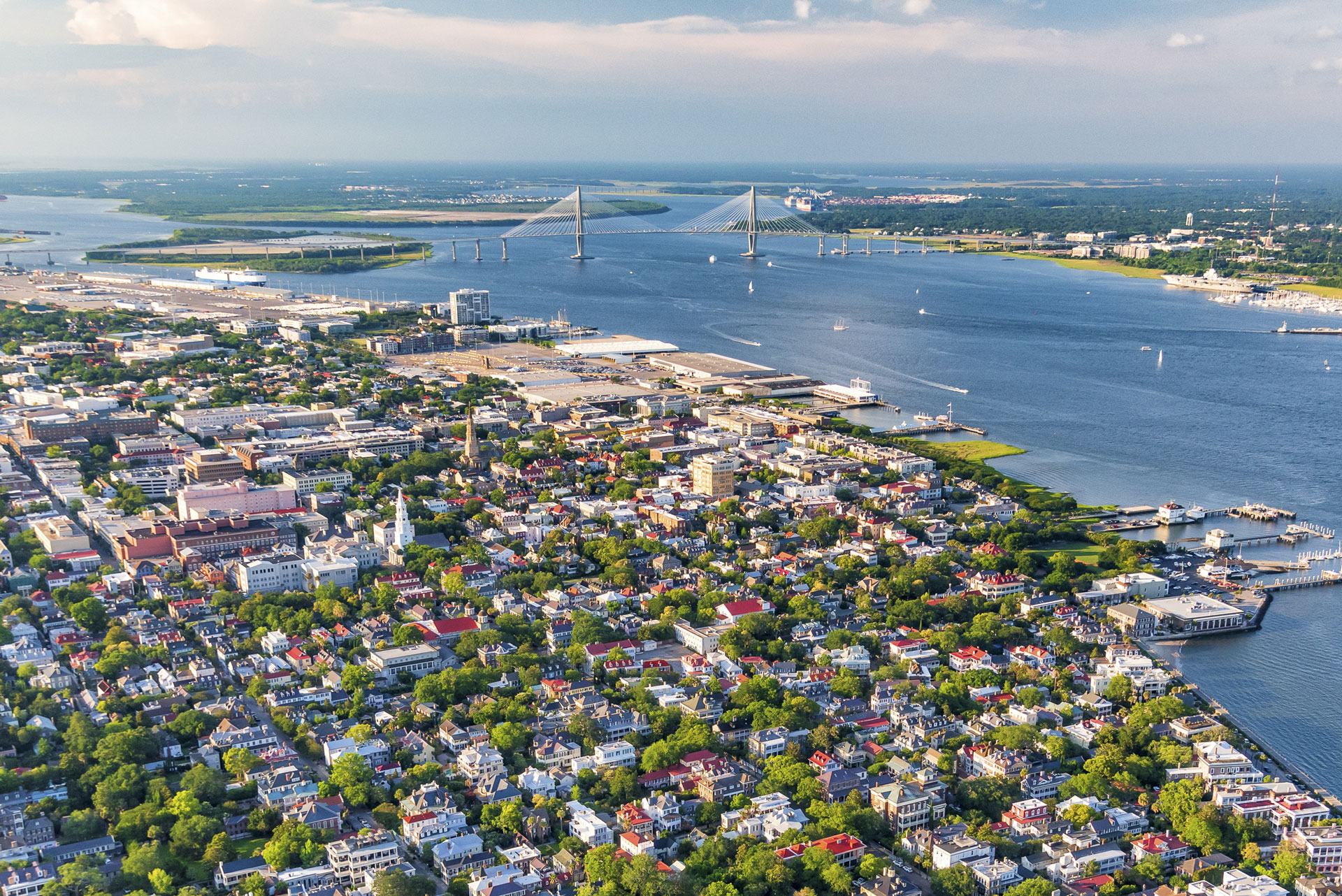
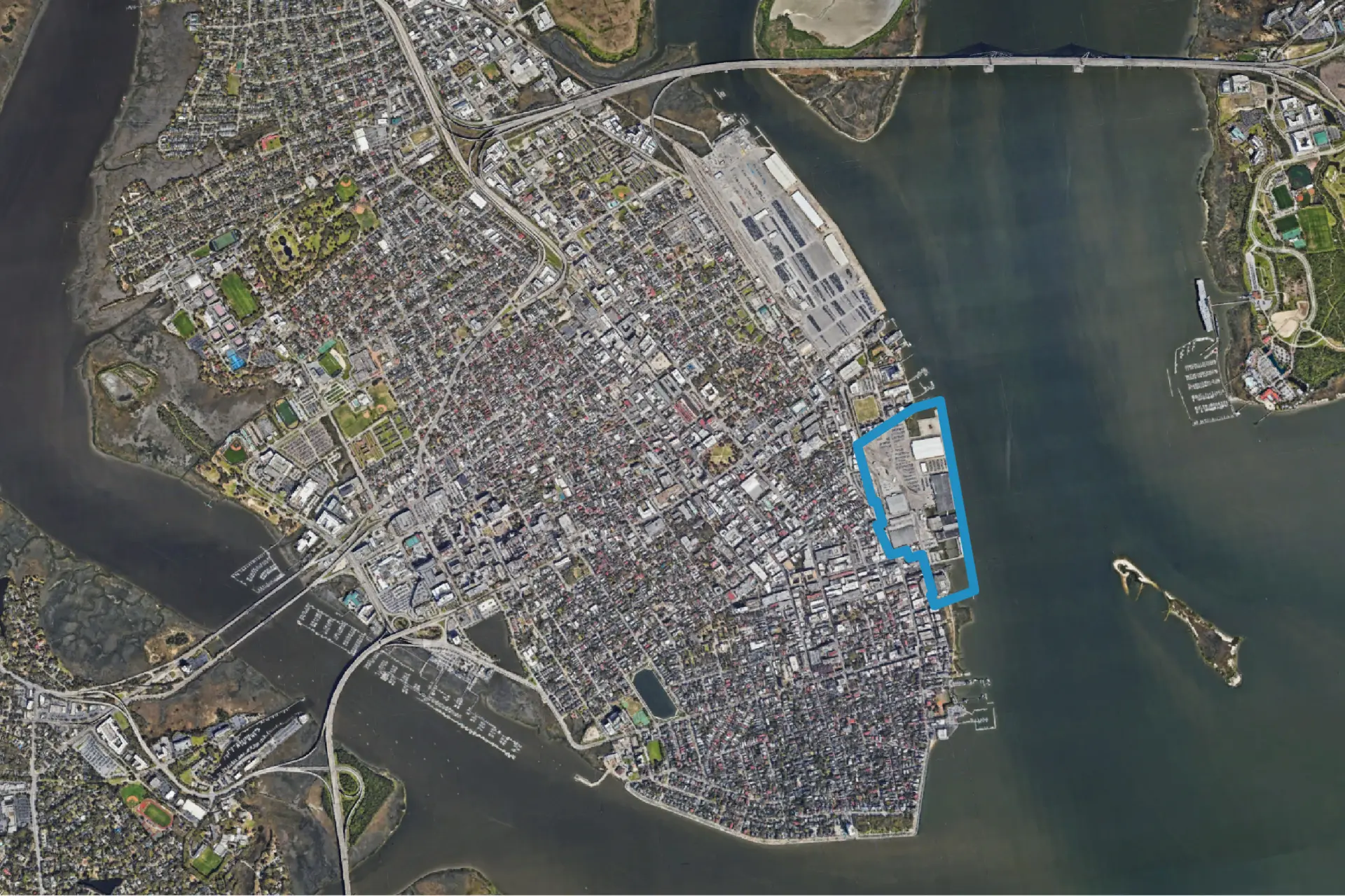
Union Pier is a 65-acre waterfront property in historic downtown Charleston. It has been used by the South Carolina Ports Authority for port and cruise operations for decades and includes docks, warehouses and parking lots.
Beemok Capital, the family office of Ben and Kelly Navarro, plans to acquire the site from the Ports Authority and serve as its long-term steward.
Civic Vision
The City of Charleston’s Comprehensive Plan serves as a roadmap for future land use and development across the city. The Union Pier component of the plan was led by the City of Charleston through an inclusive, community-driven process and was formally adopted by City Council on April 8, 2025. The following is the complete, Council-approved Comprehensive Plan language for Union Pier, which provides the blueprint for Beemok's long-term stewardship of this important property.
Urban Waterfront Future Land Use District
“These vibrant and inclusive mixed-use districts are located along portions of the Peninsula’s waterfront and areas designated as Neighborhood and City Centers. Development in these areas preserves Charleston’s rich cultural and maritime heritage and facilitates recreational, civic, and economic connections between urban areas and the waterfront. Building and site design prioritizes resilience, maintains continuous public access along the waterfront in coordination with perimeter protection, creates public access and street view corridors toward the water, and is compatible with the city’s skyline.
There are a mix of uses, including a variety of housing types for residents of diverse incomes, civic, commercial, outdoor public gathering places, and opportunities for small and local businesses. The waterfront is activated with public parks and open spaces, as well as restaurants, events, and other public and commercial uses that engage and serve the Charleston community.
Maritime recreational and transportation uses are encouraged on a scale consistent with landside uses, to replace prior cargo and cruise ship uses. Block patterns, street design and building scale and massing, which will include varying heights and densities, are compatible to the neighboring commercial and residential districts to create a properly scaled extension to the city.”